A bit of history of how the current day community of Boyd came about.
"Boyd Station, an early Kentucky settlement on the South Fork of the Licking River, 11 ½ miles NNW of the current day city of Cynthiana, the county seat of Harrison County.
On December 8, 1854, on the site of a watermill built by Whitehead Coleman in 1810, Thomas Boyd established a trading post which he named Boyd’s Station in honor of Andrew Boyd, Sr., an early Kentucky settler. Within a short time it became a coal and water supply station on the Covington and Lexington railroad and the village grew up around the station. In 1880, the outpost became simply Boyd, which name it bore until it closed."
Source: Kentucky Place Names By Robert M. Rennick
Today, Boyd is probably less populated than any other time since the establishment of Kentucky settlements in the late 1880's.
The railroad tracks still run through the town above the South Fork of the Licking River but the trains no longer stop. Whitehead Coleman's mill is a distant memory. The old 1920 Boyd bank building which burned years ago now stands long vacant across the road from the old Spicer General Store now a storage building.

The Boyd United Methodist Church shares a pastor with the sister church in nearby Berry. Attendance for the congregation on most Sundays is under twenty people. Land for the church was donated in 1920 by Oscar Rankin Clifford, the grandfather of Katie Bell for the church.

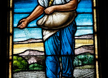
Tobacco barns still stand in Boyd but the burley tobacco crops once grown to support the family are all but gone. It has been said by one long time local that an acre of tobacco and a cow raised many of the children of Harrison County.

Show me Boyd on the map